The book tells you in simple terms how to survive as an infantry soldier in World War II, such as reading a map.
In anticipation of lost officers everywhere in the upcoming war – and created from a merger of the Engineer Reproduction Plant and the US Army’s Geographic Section (USAGS) in 1941 – the Army Map Service (AMS) is responsible for the publication and distribution of military topographic maps for US military forces. The AMS does its job well, producing 500 million topographic maps.
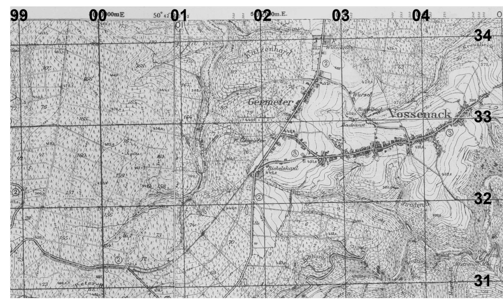
Company B used several 1:25,000 scale USAGS/AMS maps (one inch equals 25,000 inches or 694 yards) during this period. Some might be in color; some in black and white. Each has a superimposed grid system, thin black horizontal and vertical lines; each line has two digits, such as on the top 90, 91, 92 – the numbers getting larger as you go right until they hit 00, 01, 02, or on the side, getting larger as you go up. You always read right and then up. In the endnotes, you will find six-digit coordinates, the first two may give the vertical line number such as 99; the fourth and fifth show the horizontal line number. The third and sixth digits will be 0-9, because inside a square you can be exactly on the line, or one-tenth of the way to the next line, all the way up to nine-tenths. Thus, a coordinate of 985025 would be halfway between the 98 and 99 vertical lines and halfway between the 02 and 03 horizontal lines. As examples: Germeter, above, is (024333) Merode Castle (050454) Elsenborn Ridge (945083) and Kalterherberg (954135).
