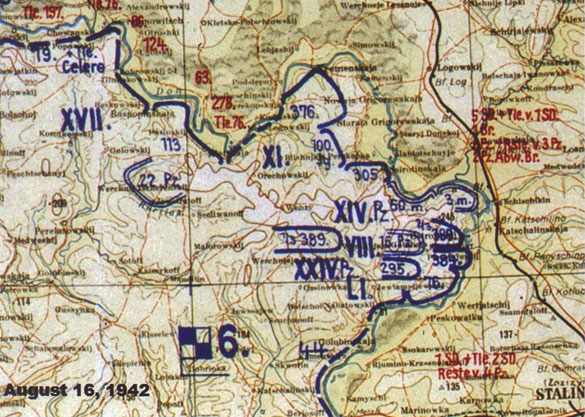
Situation Map for August 16, 1942
The book uses many daily situation maps to show where the German divisions and corps were located. This is one of the Lage Ost maps from the National Archives, where they are in photo format – the originals having been returned to Germany. The maps were initially prepared by the German Army High Command (Oberkommando des Heeres [OKH]). They were first printed by the Mapping and Survey Branch; the OKH Operations Branch then annotated then to indicate specific headquarters and unit locations. New maps were prepared daily.
The good news is that for many of these maps, you do not have to go to Washington DC and the Archives. Researcher John Calvin (WWII Aerial Photos and Maps) has put many on his own web site, as well as thousands of photos and other maps.
